Coastal Views and Seaside Sweets: Walking the Geopark Trail from Kinosaki to Takeno with a Local Guide
- Date posted
- 2026.11.10
- Date last updated
- 2026.11.13
I love travel and good food, and I’m confident in my walking stamina.
Having visited all 47 of Japan’s prefectures with my family, I have rediscovered the appeal of Hyogo’s five historic regions.
There’s still so much of Hyogo I have yet to discover!
- Nationality
- Amagasaki, Hyogo
- Hobbies
- Travel in Japan and overseas, exploring local food, and live music
INDEX
Show More
- Landscapes Shaped by the Earth: What Is San’in Kaigan Geopark?
- Exploring the Trail with Takeno Local Harushige Aoyama
- A Sweet Start: Sea-Salt Soft Serve Before the Walk
- The Coastal Walk Begins at Kinosaki Marine World and Hiyoriyama
- Hilltop Panoramas and an Unexpected Ancient Tomb
- The Secret of Takuhi’s Brilliant Green Rocks
- Ui’s Boathouses: Shelter from the Fierce Sea Winds
- At Last, Takeno Beach: One of Japan’s 100 Best Beaches
- Shiokaze Pudding at GRILL ALGUE in Okukinosaki Seaside Hotel
- Unwind by the Sea at Uminone
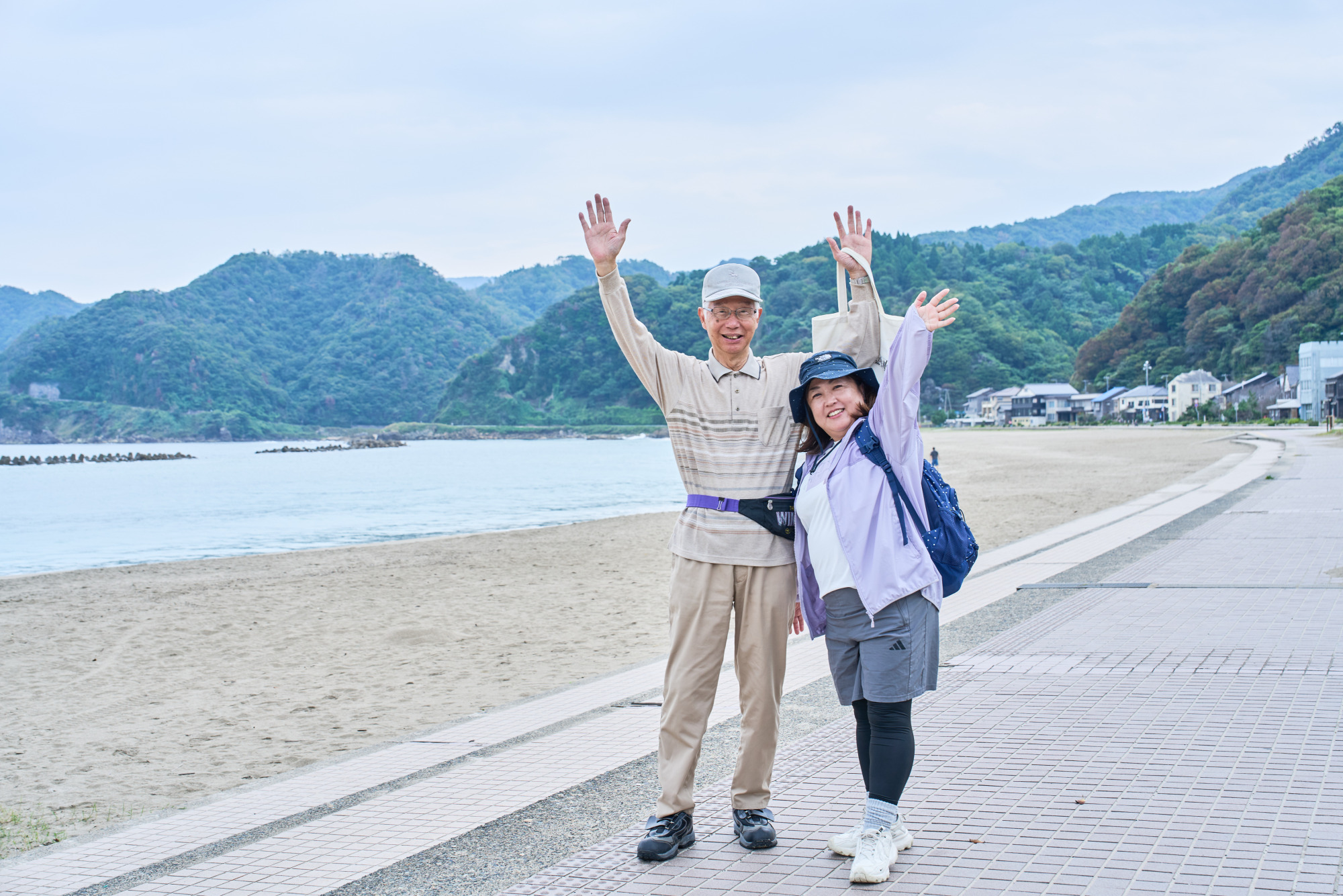
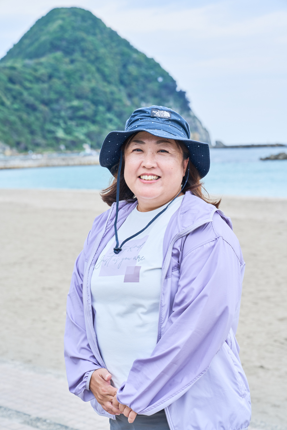
San’in Kaigan is a UNESCO Global Geopark, and its dramatic landscapes are best explored on foot along the San’in Kaigan Geopark Trail. I’m Kayo Tokuyama, a keen walker from Amagasaki in Hyogo Prefecture, and this is my first geopark trail walk. Join me and our knowledgeable local guide, Mr. Aoyama, for a roughly 9.5 km journey from Kinosaki Marine World to Takeno Beach, with spectacular scenery and delicious treats along the way!
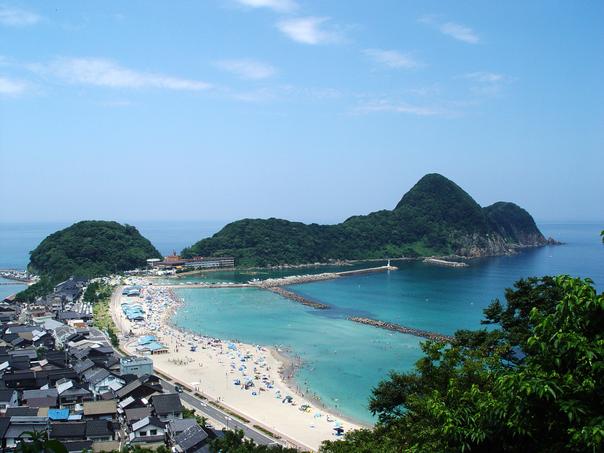 Photo courtesy of the San’in Kaigan Geopark Promotion Council
Landscapes Shaped by the Earth: What Is San’in Kaigan Geopark?
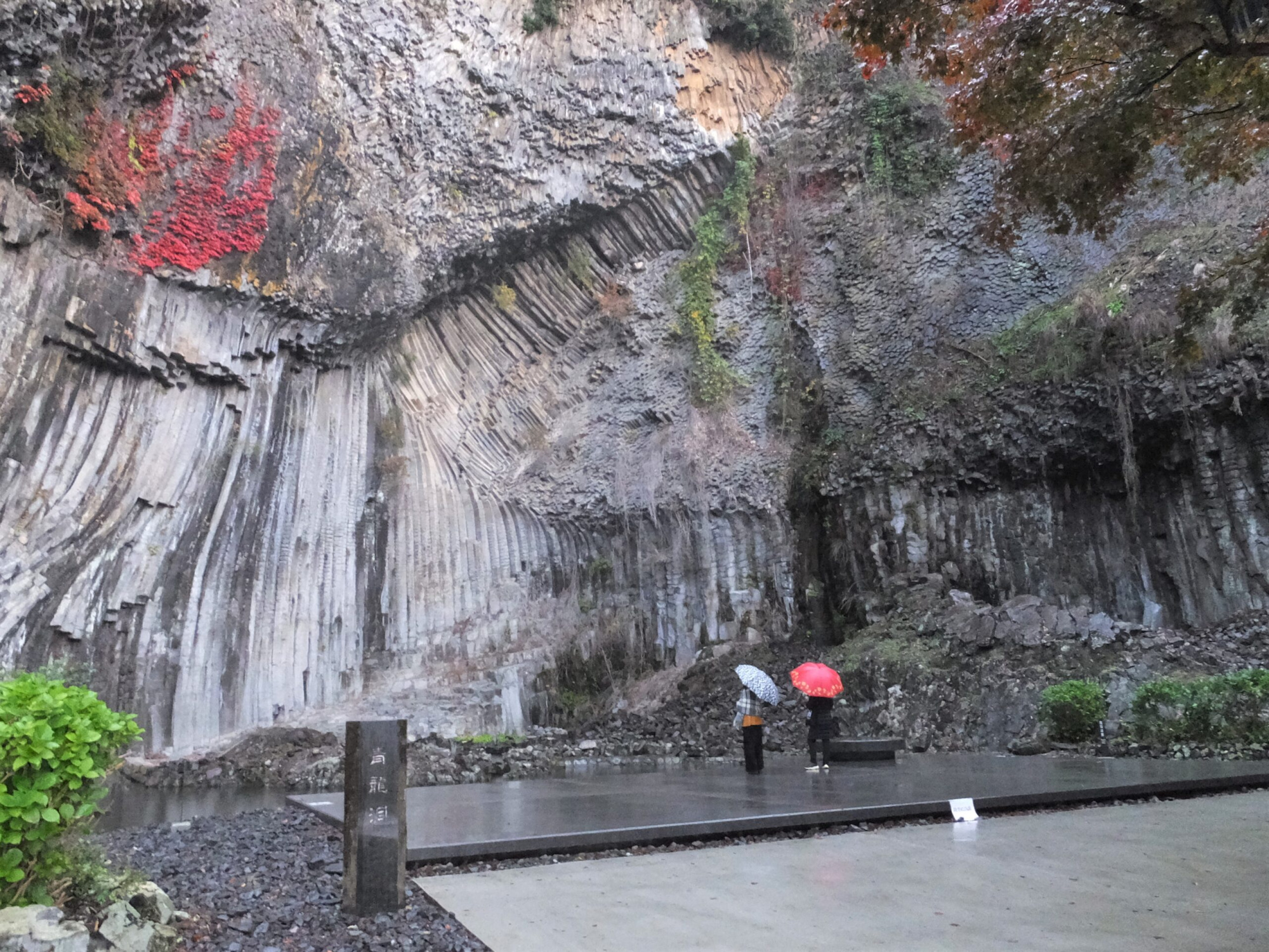 Seiryudo Cave in Genbudo Park, one of San’in Kaigan Geopark’s highlights. Note: This site is not on the walking route featured in this article.(Photo courtesy of the San’in Kaigan Geopark Promotion Council)
The rock layers and fossils preserved in San’in Kaigan Geopark tell an extraordinary story: from around 50 million years ago, when what is now Japan was still part of the Eurasian continent, to its separation from the continent and the formation of the Sea of Japan around 25–15 million years ago. The geopark spans six municipalities in three prefectures: Kyotango in Kyoto; Toyooka, Kami, and Shinonsen in Hyogo; and Iwami and Tottori in Tottori Prefecture.
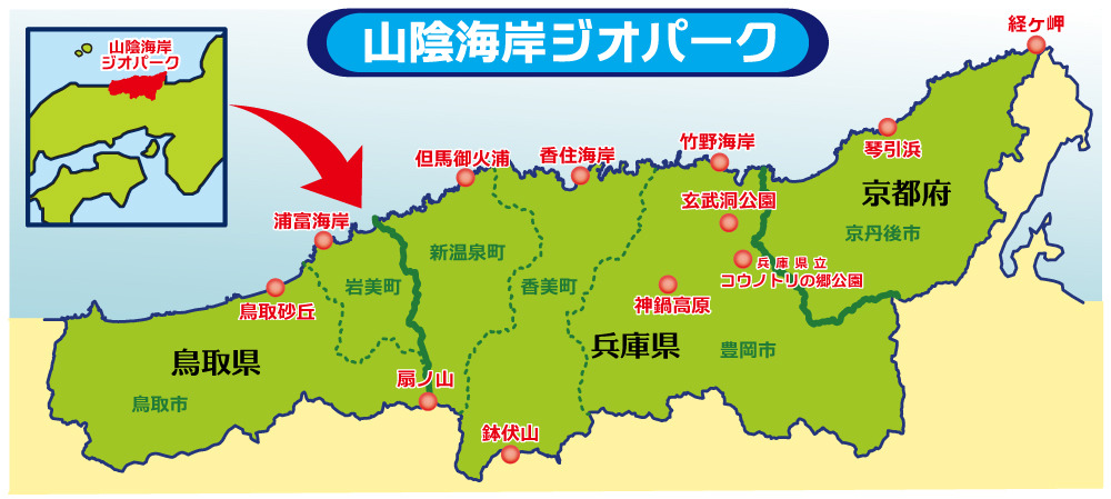 Map of San’in Kaigan Geopark
Walking the San’in Kaigan Geopark Trail lets you discover not only the geology and landforms that reveal the Earth’s history, but also the lives and cultures shaped by this landscape. Its 27 routes cover approximately 230 km in total, with individual walks ranging from 2.8 km to 21.4 km and options for beginners as well as more experienced walkers. You can tackle the trail over several days or simply enjoy a section that interests you. For this visit, I walked Course 20, a roughly 9.5 km route from Kinosaki Marine World to Takeno Beach recommended for beginners and intermediate walkers, accompanied by local guide Harushige Aoyama.
Exploring the Trail with Takeno Local Harushige Aoyama
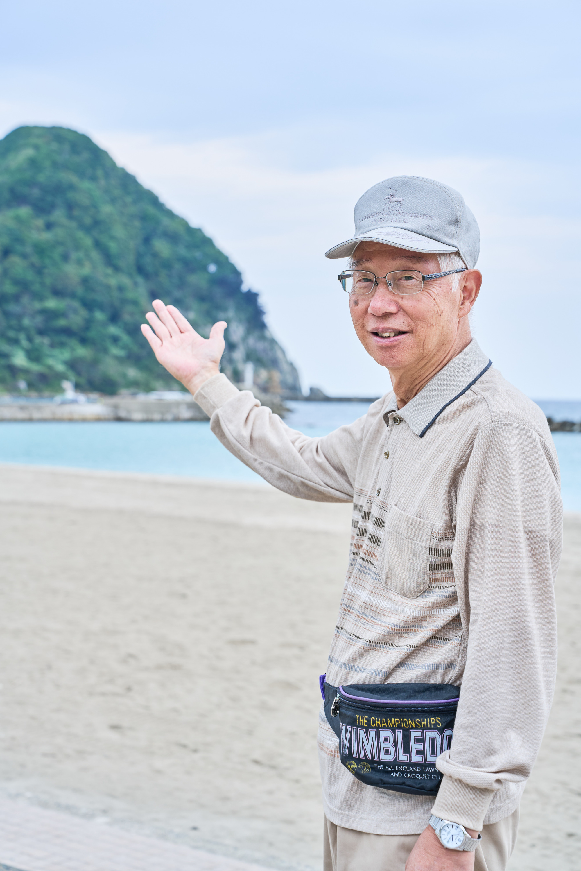
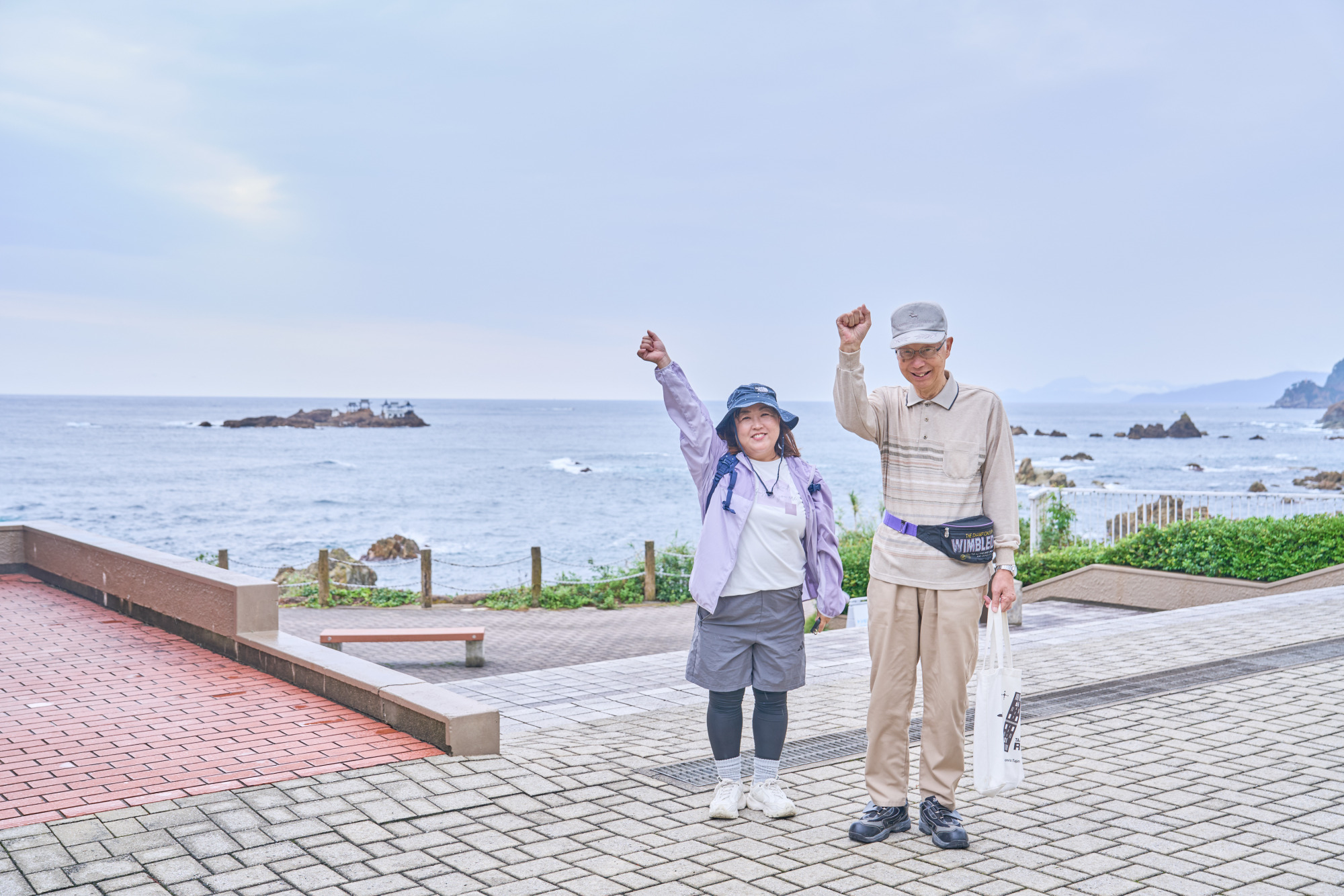
Born and raised in Takeno, our guide Harushige Aoyama knows the area inside out. After working in his family’s construction business until the age of 60, he became a guide on Takeno’s sightseeing boats and served for seven years as chair of the local tourism association. In 2011, he joined other local volunteers to establish the Buratakeno organizing committee, which works to revitalize the town.
“When you understand how the land was formed and how people have lived alongside the sea, scenery you might otherwise walk past starts to look completely different,” Mr. Aoyama tells us. Drawn in by his warm manner, deep knowledge, and love for his hometown, I’m ready to set off!
A Sweet Start: Sea-Salt Soft Serve Before the Walk
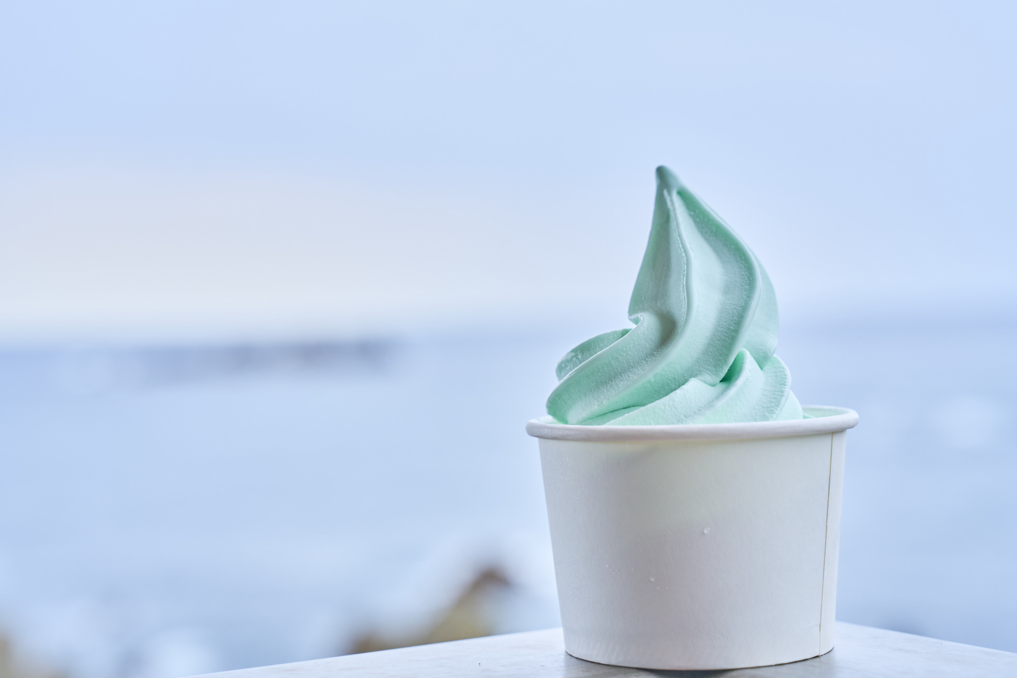 Umi no Shio Soft, a sea-salt soft-serve ice cream (¥450, tax included).
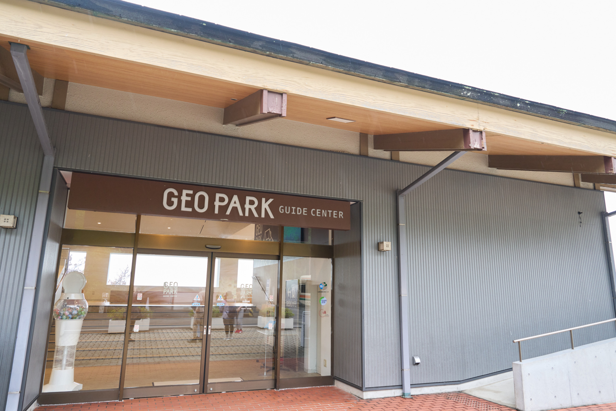 Hiyoriyama Coast Guide Center.
Before hitting the trail, I stop for a little sweet fuel at Geo Cafe, in the free-admission area of Kinosaki Marine World, our starting point. The treat to try here is Umi no Shio Soft, a soft-serve ice cream made with Tanjo no Shio, a local salt produced from seawater off the coast of Takeno. The ice cream has received the Geopark Promotion Council’s “Geo no Ippin” designation, awarded to products that showcase the region’s natural bounty, history, and culture.
A subtle salty accent brings out the rich, milky sweetness, with a refreshing flavor that somehow reminds me of ramune, Japan’s classic lemon-lime soda. It’s just the energy boost I need before setting off. Next door, the Hiyoriyama Coast Guide Center has maps of the wider geopark and information on nearby sights.
The Coastal Walk Begins at Kinosaki Marine World and Hiyoriyama
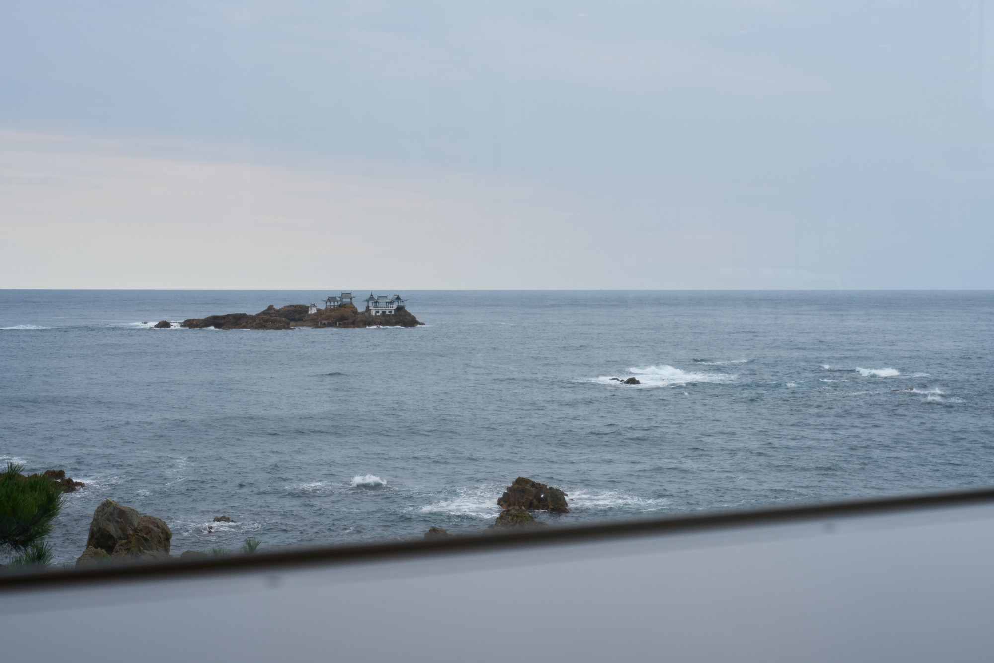 Nochigashima Island, associated with the Japanese folktale Urashima Taro.
Soft serve finished, it’s time to begin the roughly 9.5 km walk. Hiyoriyama Coast makes a striking starting point, with towering walls of volcanic rock and a rugged shore carved by the powerful waves of the Sea of Japan. Offshore stands the small island of Nochigashima, associated with the Japanese folktale of Urashima Taro, a fisherman who visits a palace beneath the sea. A pavilion on the island modeled after the Dragon Palace from the story lends the scene a dreamlike atmosphere.
Hilltop Panoramas and an Unexpected Ancient Tomb
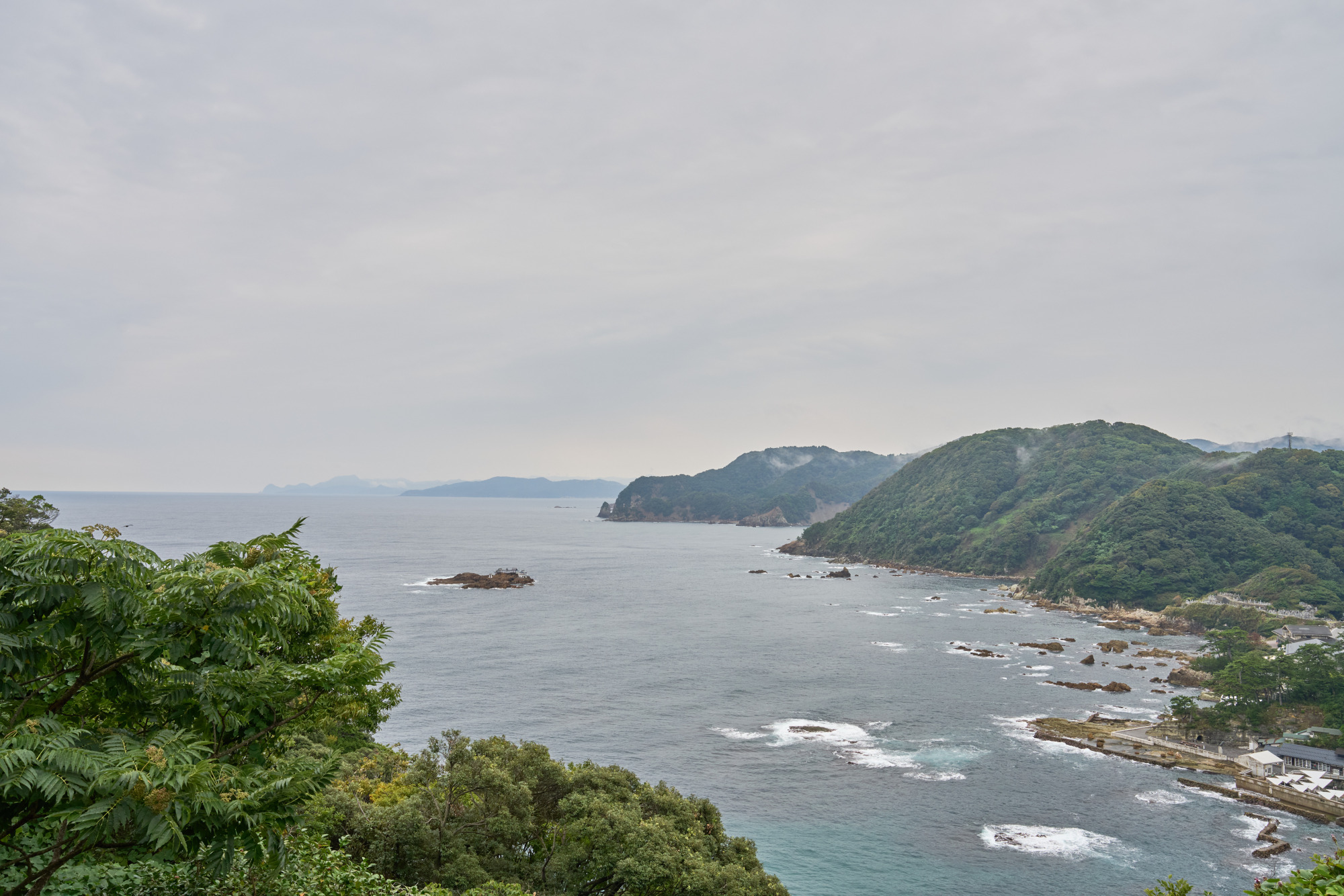 The view from Omachi Cape.
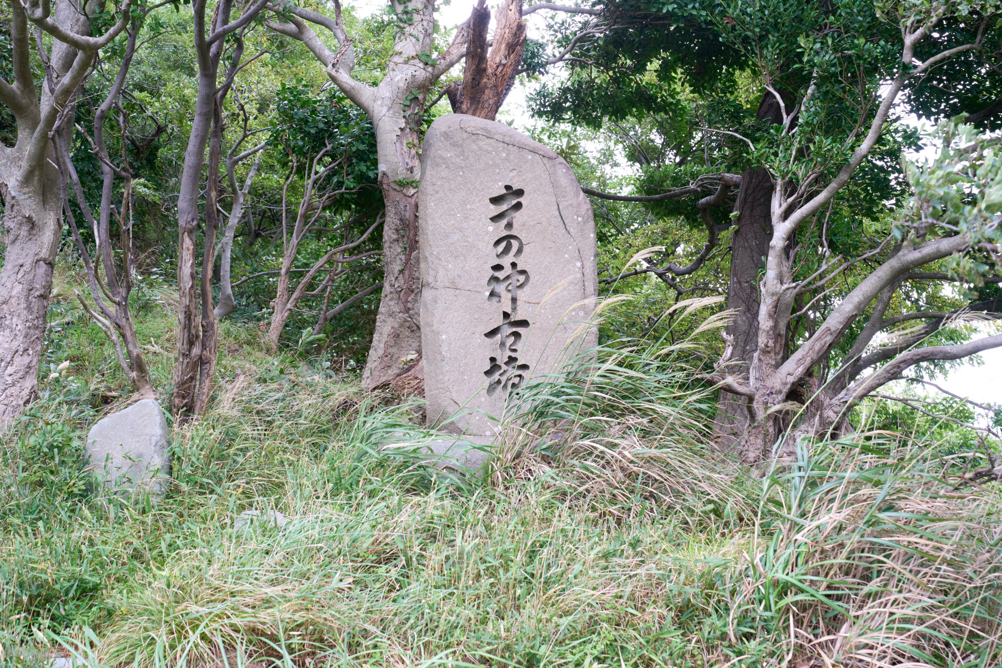 A stone marker for Sai no Kami Kofun, an ancient burial mound.
After a 15-minute uphill walk from Kinosaki Marine World, I’m a little out of breath. Then, at the top, the view suddenly opens up! The panorama from Omachi Cape is breathtaking: Hiyoriyama Coast lies below, and an intricate coastline of inlets and headlands stretches all the way to Inugasaki Cape on the Tango Peninsula. This deeply indented landscape is known as a ria coast, formed when rising sea levels submerge river valleys.
Farther along, I spot a roadside stone marker for Sai no Kami Kofun. A kofun—an ancient burial mound—here of all places!
“After the war, construction began on the Hokutan coastal development road. During excavation work on the steep mountainside by Japan’s Ground Self-Defense Force, archaeological remains and pottery fragments were unearthed,” Mr. Aoyama explains.
The Secret of Takuhi’s Brilliant Green Rocks
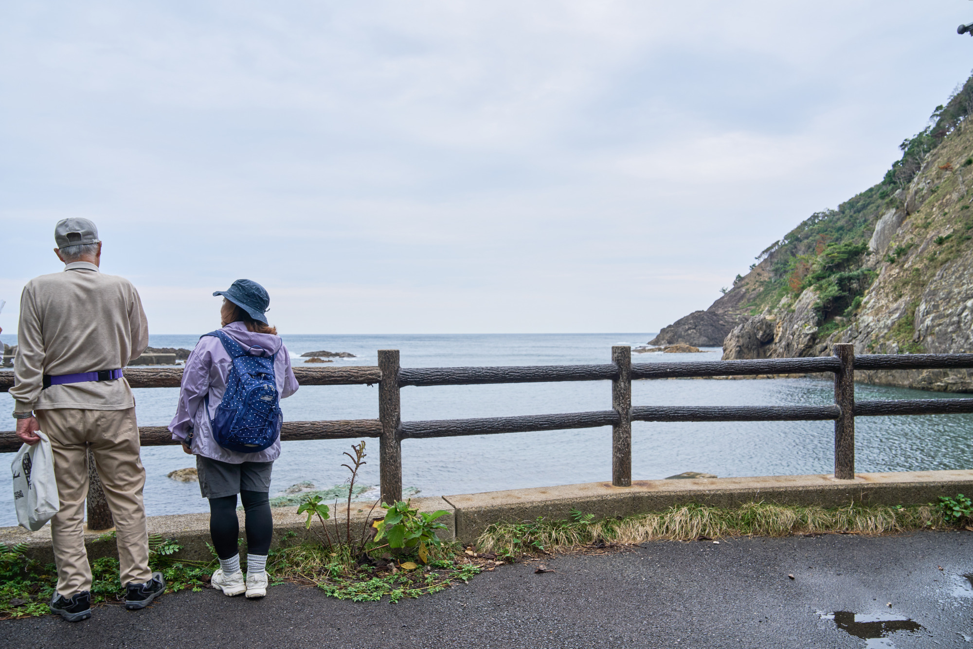 Takuhi’s coast.
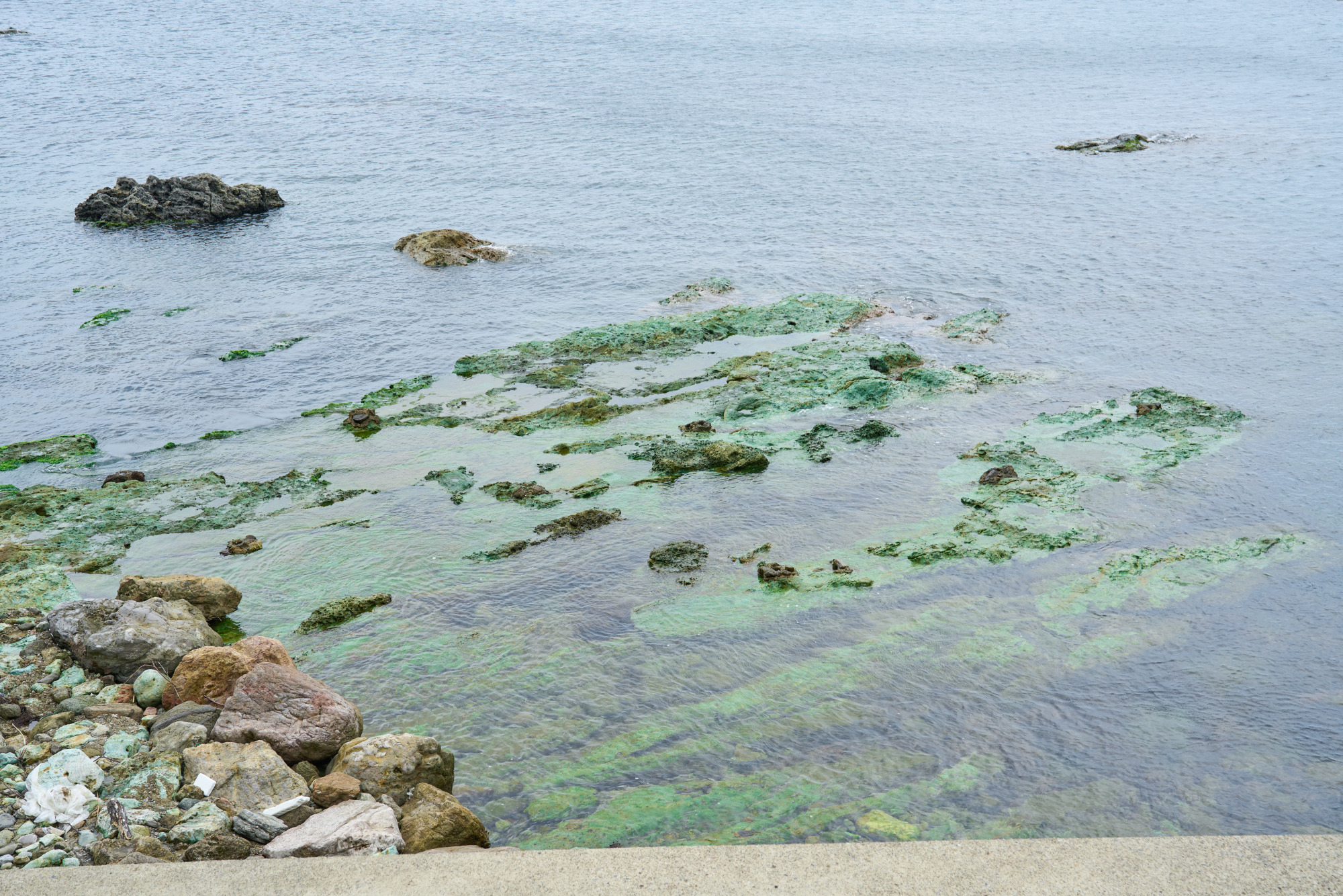 Green tuff, a rock formed from volcanic ash.
Descending from the hilltop, I reach Takuhi, a quiet fishing village tucked into the indented coastline. Local tradition holds that members of the defeated Heike clan, a medieval warrior family, once took refuge here. Mr. Aoyama points to a mysterious emerald-green rock surface visible in the sea. At first glance, it looks as though it is covered with algae or moss.
“That unusual green is actually the color of the rock itself,” he explains. “It’s called green tuff. Tuff is rock formed from consolidated volcanic ash, and in western Japan this green variety is found only in limited areas along the Sea of Japan coast. Around 20 million years ago, when the Sea of Japan was taking shape, ash from undersea volcanic activity reacted with seawater to create it. It’s one of the trail’s hidden highlights—you really are walking across the Earth’s history.”
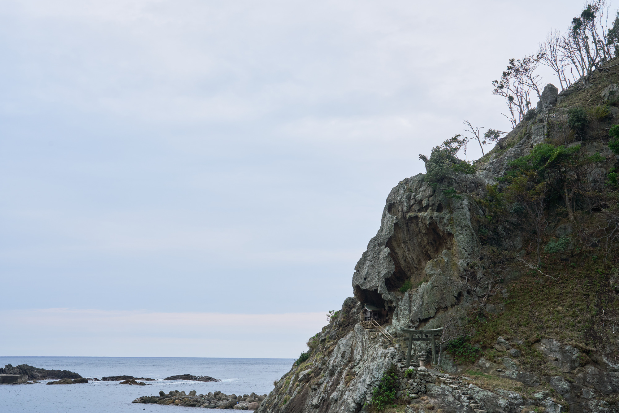 Takuhi Benzaiten Shrine.
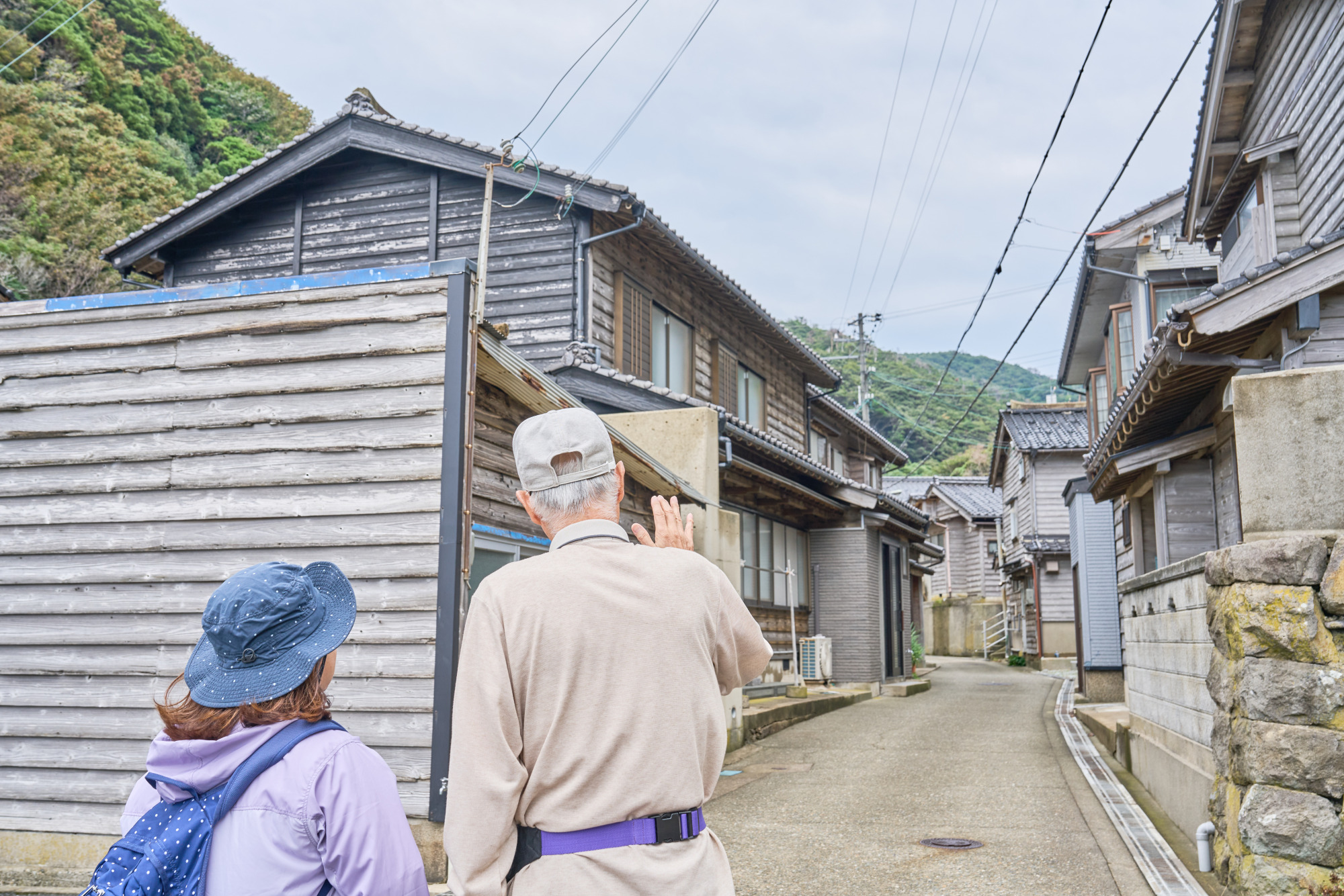 The village of Takuhi.
In the village, Takuhi Benzaiten Shrine occupies a hollow created by weathering and erosion, where whale bones have been placed as offerings. Behind the torii—the traditional shrine gateway—facing the sea, the rock is pitted with holes formed by weathering from salt-laden air and erosion by waves. The houses also reveal ways of coping with the harsh climate: charred cedar boards clad the walls, and stones weigh down the roof ridges. “Until the Tajima coastal road opened in 1965, this village was virtually cut off from the outside world,” Mr. Aoyama says. “To go anywhere, people had to travel by boat or risk their lives on steep mountain paths.” Looking around the peaceful village, I can hardly imagine the hardships of its past.
Ui’s Boathouses: Shelter from the Fierce Sea Winds
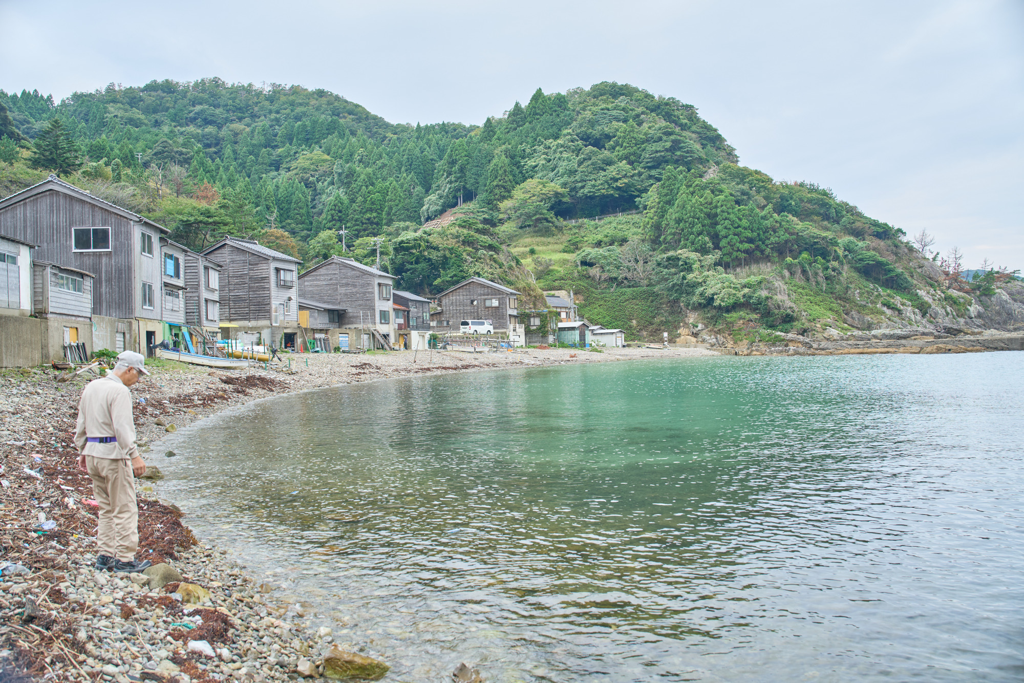 Boathouses in Ui.
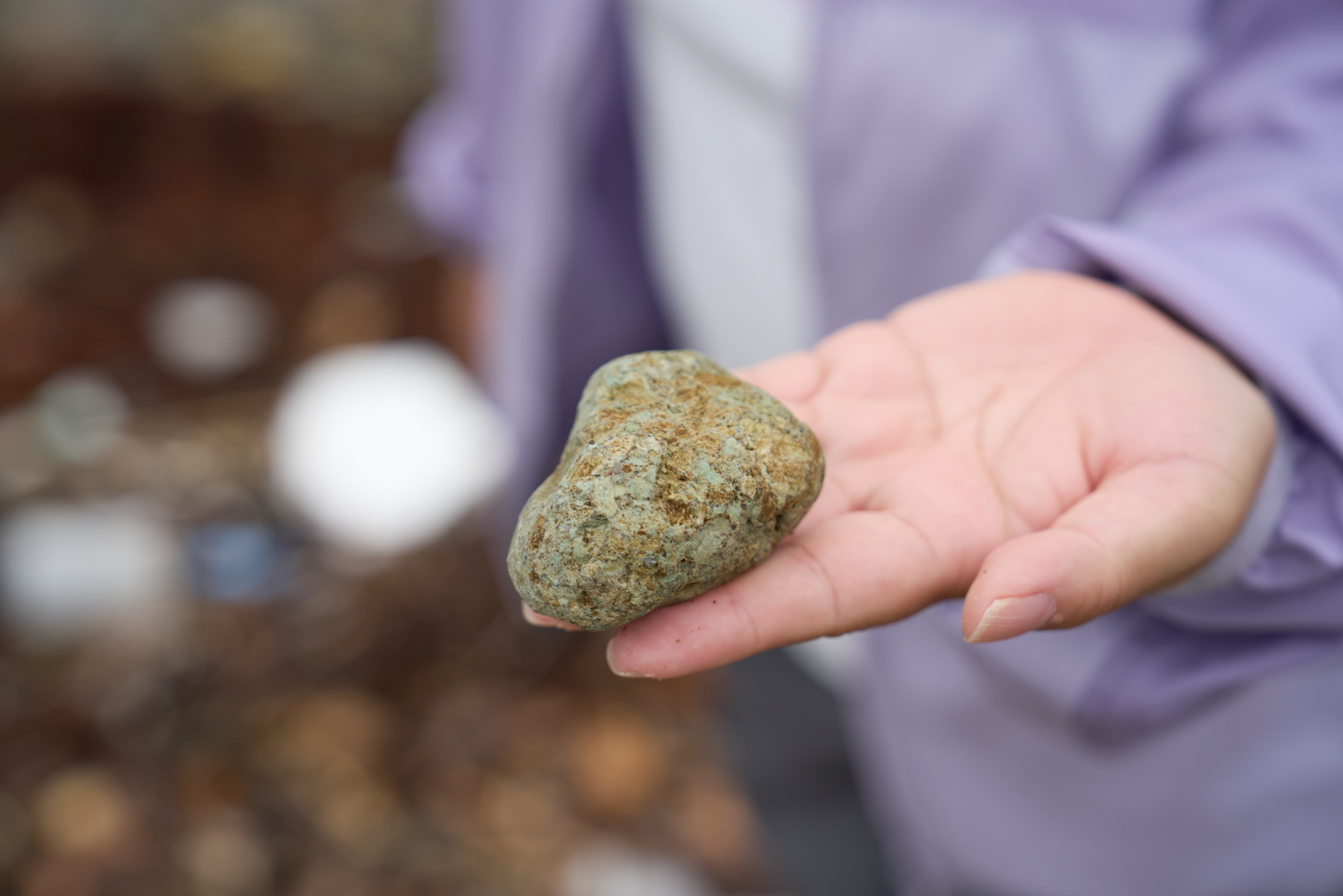 Pebbles of green tuff, a rock formed from volcanic ash.
Leaving Takuhi, I continue to the neighboring village of Ui. It is one of the few places in Japan where distinctive funaya—boathouses integrated into homes—survive. These buildings sheltered fishing boats from the Sea of Japan’s fierce winter winds and waves.
“People used to pull their boats straight into their houses,” Mr. Aoyama tells us. The homes huddled around the inlet offer a glimpse of the practical wisdom of a fishing community that has long lived with demanding natural conditions.
The beach is scattered with blue-green pebbles of green tuff. Rounded by waves over countless years, they are fragments of sedimentary rock, which, as Mr. Aoyama explained, are made from compacted volcanic ash produced by undersea eruptions around 20 million years ago, as the Sea of Japan was forming. Chemical changes gave them their distinctive color. Without that explanation, I might never have given them a second glance.
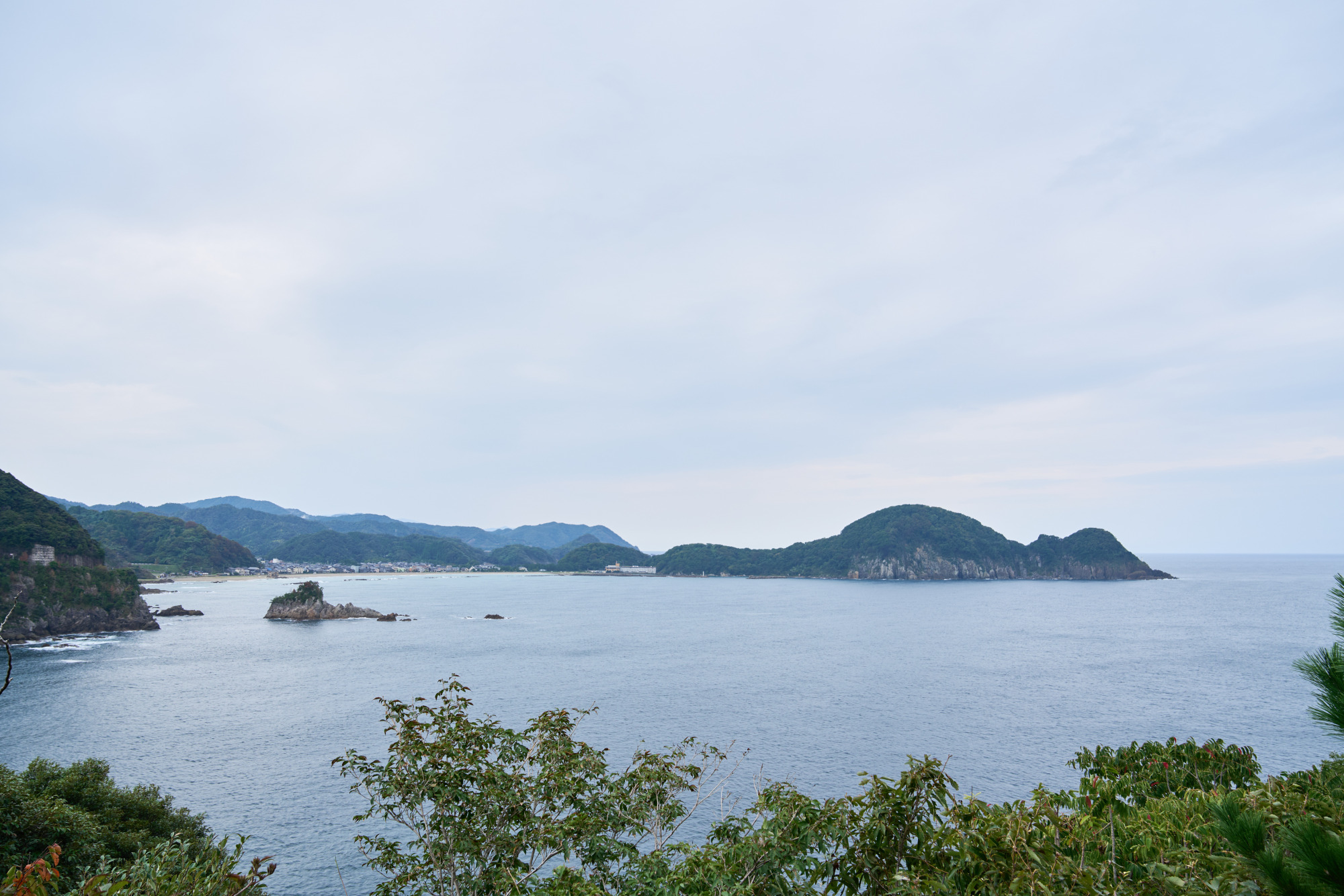 Nekozaki Peninsula resembles a Kewpie doll, a round-bodied baby doll, lying on its back.
Along the way, Nekozaki Peninsula comes into view. Doesn’t its outline look like a baby lying contentedly on its back? Locals compare it to a Kewpie doll, a cherubic baby doll with a rounded head and plump body. Seen from a boat out at sea, it is also said to resemble a cat curled up with its body tucked in.
At Last, Takeno Beach: One of Japan’s 100 Best Beaches
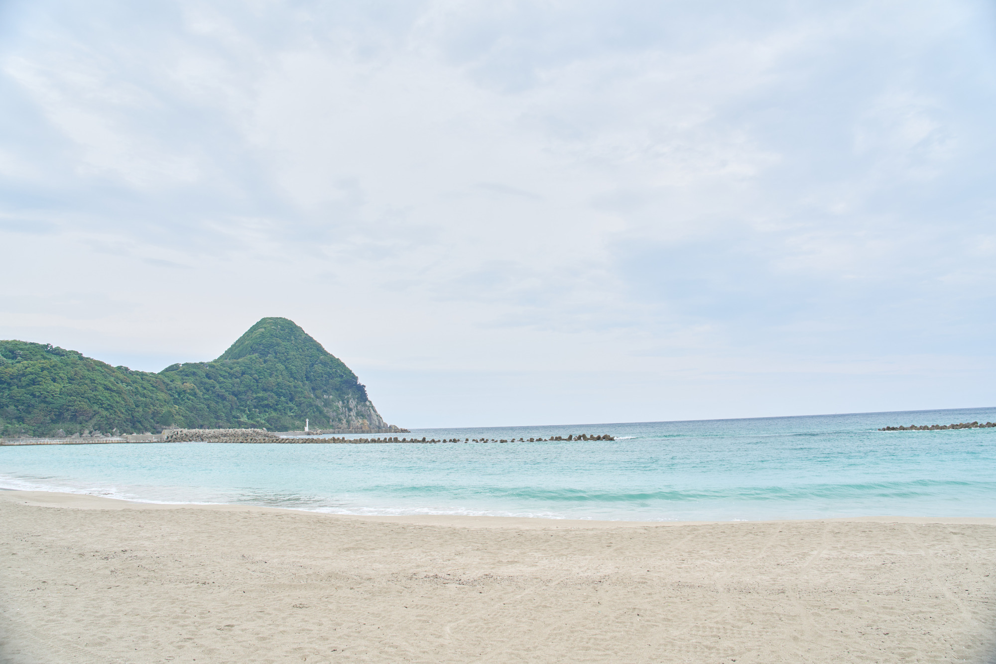 Takeno Beach.
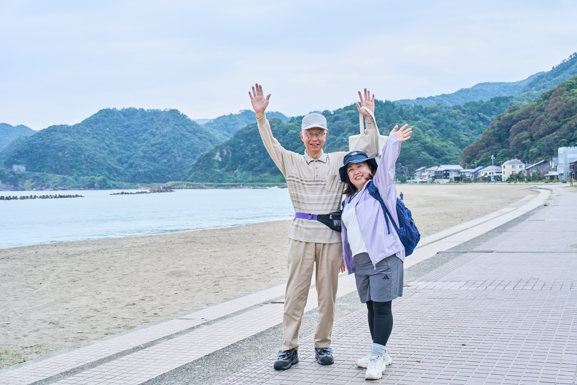
With the sound of waves beside me, I follow the road and finally reach Takeno Beach, our destination! Its fine white sand and clear emerald-green sea make it one of the finest beaches in the Kansai region of western Japan. It has been selected for both Japan’s “100 Best Beaches” and “100 Best Bathing Beaches,” the latter recognizing outstanding swimming beaches.
Shiokaze Pudding at GRILL ALGUE in Okukinosaki Seaside Hotel
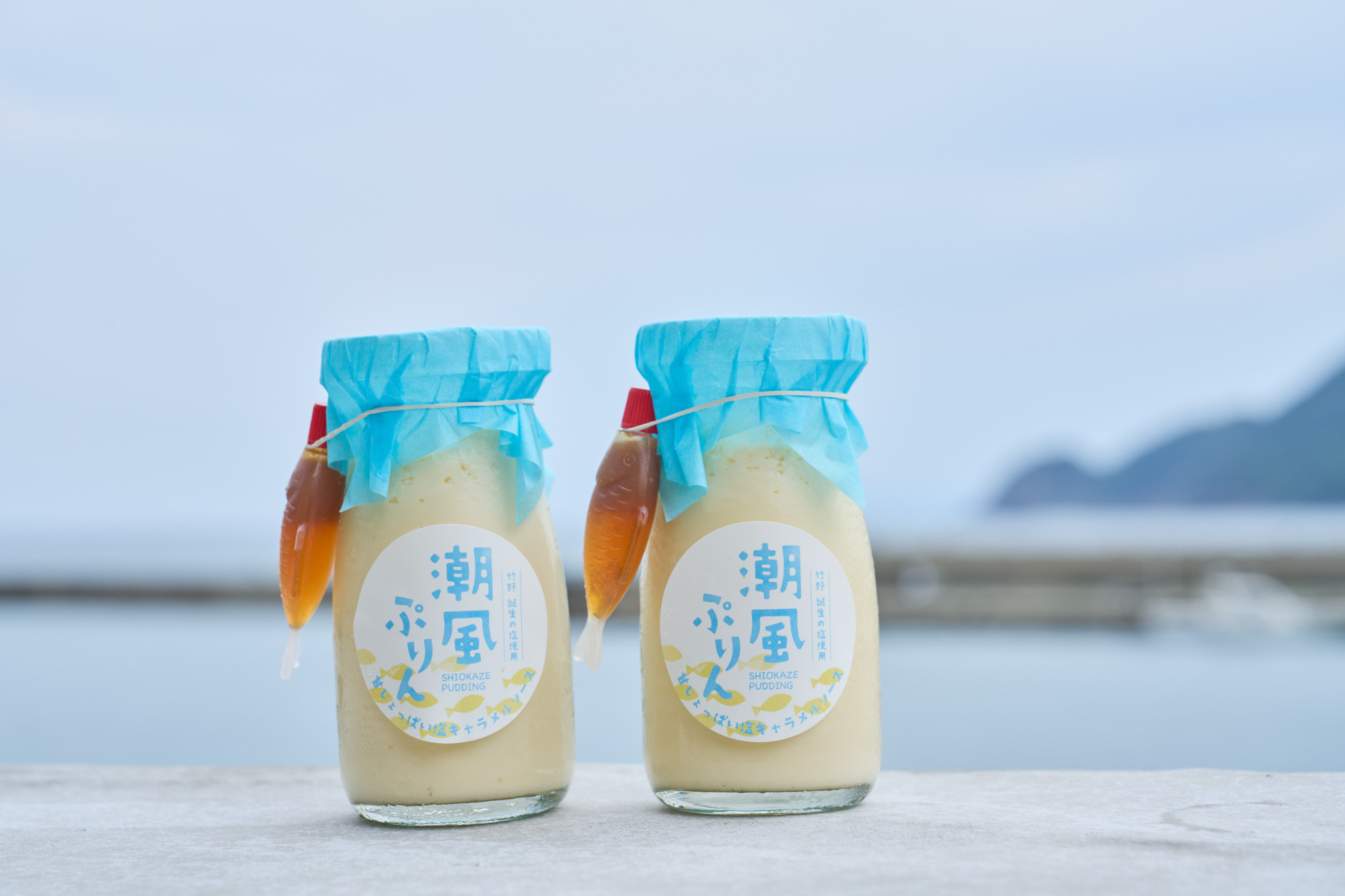 Shiokaze Pudding (¥600, tax included).
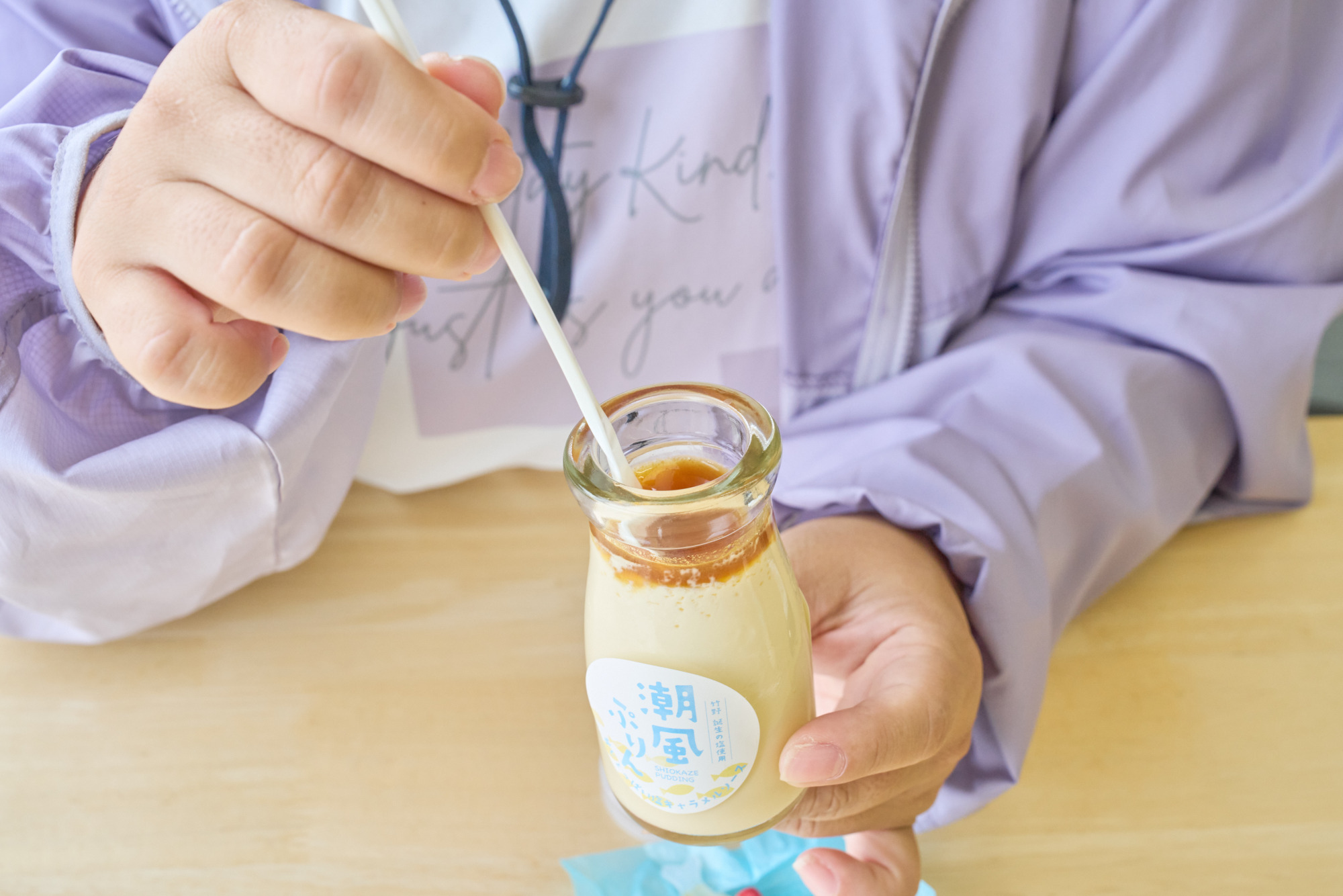
After completing the roughly 9.5 km trail, it’s time for a well-earned treat. Right across from Takeno Beach is Okukinosaki Seaside Hotel, whose first-floor restaurant and café, GRILL ALGUE, serves Shiokaze Pudding, a creamy custard dessert. Served with salted caramel sauce made using Takeno’s Tanjo no Shio sea salt, the pudding has also received the “Geo no Ippin” designation for distinctive local products. It tastes especially good after a long walk. Looking out through the large windows at Takeno’s calm sea makes the moment feel wonderfully indulgent.
Unwind by the Sea at Uminone
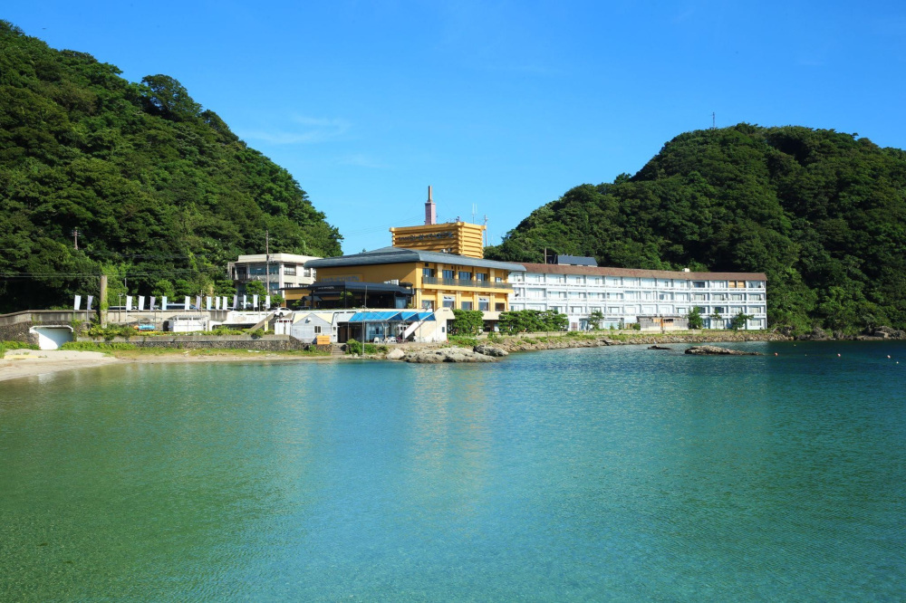
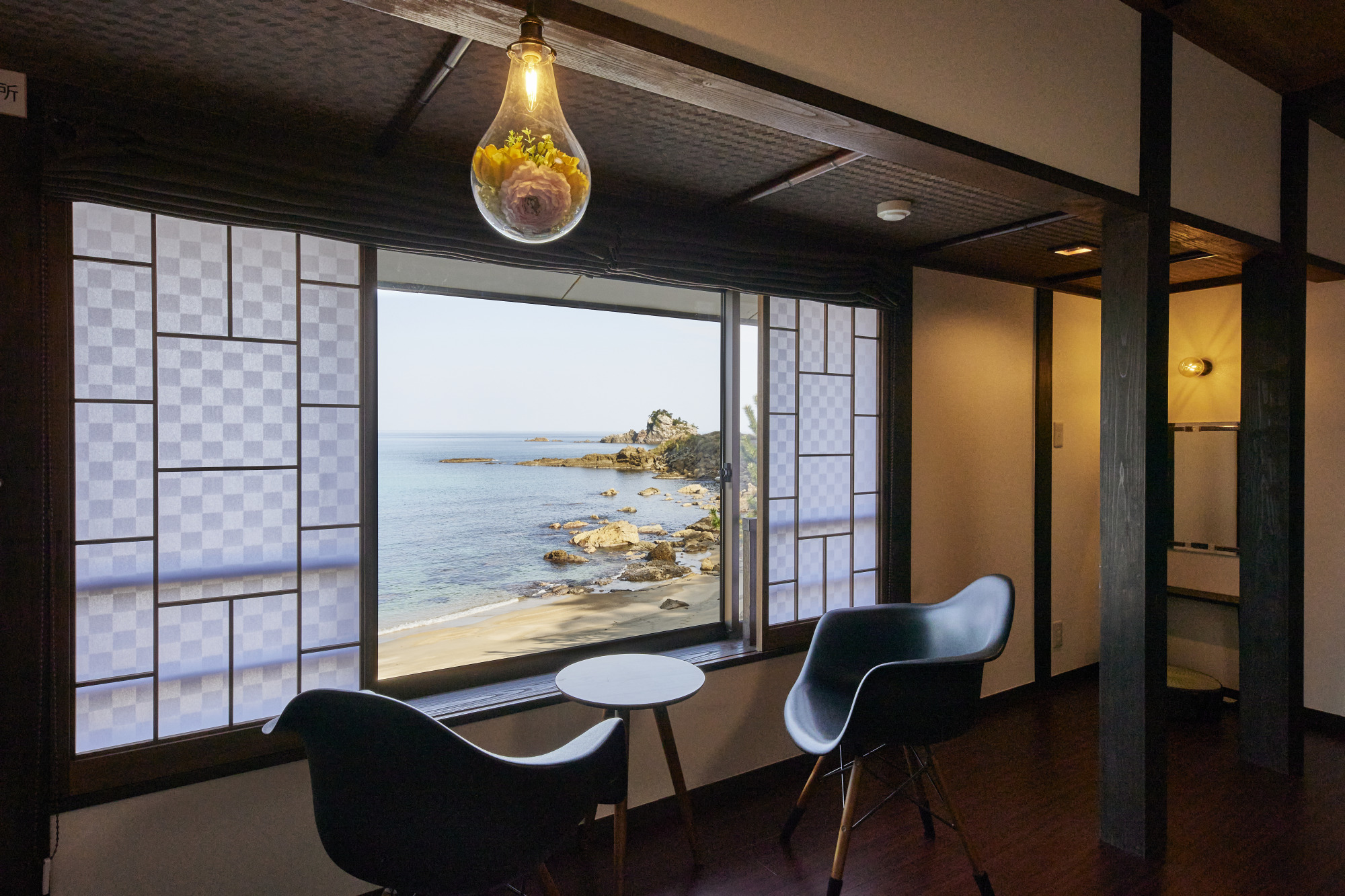 Takeno no Umibe Yuyado Uminone.
For more relaxation, head to Uminone, a welcoming eight-room inn beside Takeno Beach. Every room has an ocean view, with the Sea of Japan stretching out in front of you and the soothing sound of waves nearby. The inn’s two communal baths draw water from Takeno Onsen, which is said to leave skin feeling smooth. The hot spring rises near the sea, and its high salt content helps keep you thoroughly warmed after bathing. A Finnish-style barrel sauna is another attraction, and day visitors can use the hot spring baths without staying overnight. It sounds like a lovely way to soothe tired muscles after the trail and wake up refreshed the next day.
Walking the San’in Kaigan Geopark Trail with Mr. Aoyama brings far more than beautiful views. His explanations bring to life both the region’s geological history stretching back 20 million years ago and the culture of communities that have long lived alongside this demanding sea. Put on your walking shoes and come discover the dramatic natural landscapes of northernmost Hyogo!
[Frequently Asked Questions]
(Q)What area does San’in Kaigan Geopark cover?
(A)It extends from Kyogamisaki Cape in Kyotango, Kyoto Prefecture, in the east to Aoya Coast in Tottori City, Tottori Prefecture, in the west (or the area around Hakuto Coast). The area measures approximately 120 km from east to west and up to 30 km from north to south.
(Q) Can I arrange a geopark guide?
(A)Guides are available in each area. Once you have decided where you would like to go, consult the list of registered guide organizations on the official website and contact the relevant group by phone or email.
Registered guide organizations (Japanese): https://sanin-geo.jp/guidegroup/
(Q)Are there free facilities where I can learn more about the geopark?
(A)Options include the following:
Shinonsen Town San’in Kaigan Geopark Center (Shinonsen, Hyogo)
Kami Town Geopark and Sea Culture Museum (Kami, Hyogo)
Takeno Kitamaekan Kazemachi Museum (Takeno, Toyooka, Hyogo)
San’in Kaigan Geopark Museum of the Earth and Sea (Iwami, Tottori)
[Visitor Information]
◇San’in Kaigan Geopark Promotion Council Secretariat
Hyogo Prefecture Toyooka Government Office, 7-11 Saiwai-cho, Toyooka, Hyogo
◇Geo Cafe, Kinosaki Marine World
Inside Hiyoriyama Coast Guide Center, 1090 Seto, Toyooka, Hyogo
Tel: 0796-28-2300
Hours: 10:00–16:30
Open daily
Official website (English): https://marineworld.hiyoriyama.co.jp/english
Geo Cafe details (Japanese): https://marineworld.hiyoriyama.co.jp/park/geo-cafe
◇GRILL ALGUE, Okukinosaki Seaside Hotel
4 Takeno, Takeno-cho, Toyooka, Hyogo
Tel: 0796-47-0606
Hours: 8:00–20:00 (last orders 19:30)
Open daily
https://www.okukinosaki.jp/en/
◇Takeno no Umibe Yuyado Uminone
3396-1 Takeno, Takeno-cho, Toyooka, Hyogo
Tel: 0796-43-6888